
Whether you’re designing a computer game, designing a new building in town or managing a construction site we’ll have the 3D model ready for you on the format you like and the quality you need.
Our drones place professional-quality aerial maps and surveys into the hands of builders, project managers and decision makers in a way that is faster, more cost-effective, and safer than ever before.
There’s a lot to keep track of on your job site — project progress, the location of equipment, the volume of materials left — we provide aerial imagery that makes it all a lot easier.
Orthomosaics
Volumetric Data
Terrain Models
3D Models
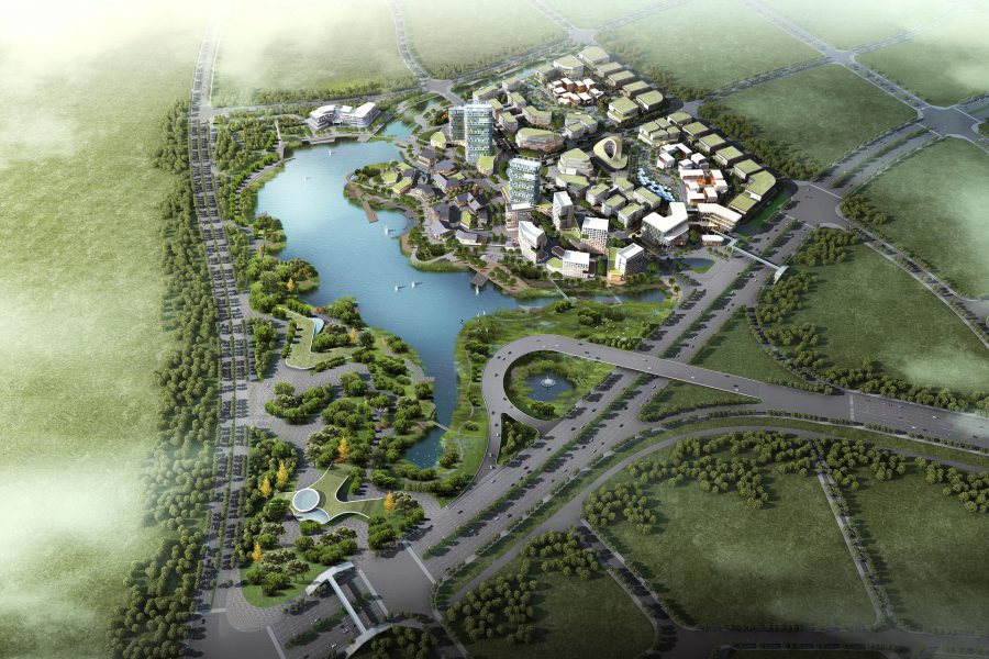
Drone Aerial 3D Mapping
Drone aerial 3D mapping is revolutionizing the way businesses and organizations view the world around them. By utilizing drones, modern technology, and sophisticated software, aerial 3D mapping can quickly create detailed, accurate three-dimensional representations of large areas in a fraction of the time it would take using traditional methods. This gives users the opportunity to gain insight into their environment in ways they never thought possible. From surveying land for construction projects to creating interactive 3D maps for marketing, drone aerial 3D mapping is transforming the way we view and interact with the world.
What is Drone Aerial 3D Mapping?
Drone aerial 3D mapping is the process of using a drone to capture high-resolution aerial photographs of a specified area. These photographs are then stitched together to create a three-dimensional map of the area. This map can be used for a variety of purposes from surveying land to creating interactive 3D maps for marketing.
The process of creating a 3D map begins with the drone operator selecting an area to be mapped. The drone is then flown over the area in a grid pattern, taking multiple photographs at different angles. These photographs are then uploaded to a computer and stitched together to create a three-dimensional map.
The accuracy of the 3D map depends on the quality of the photographs taken by the drone. The higher the resolution of the photographs, the more detailed the 3D map will be.
Benefits of Drone Aerial 3D Mapping
There are numerous benefits to using drone aerial 3D mapping over traditional methods of surveying and mapping.
The first is speed. Drone aerial 3D mapping can quickly create detailed, accurate maps of large areas in a fraction of the time it would take using traditional methods. This allows businesses and organizations to quickly survey and map an area without having to wait for lengthy surveys to be completed.
The second benefit is cost. Drone aerial 3D mapping is much more cost-effective than traditional methods of surveying and mapping. In addition, the cost of the drone itself is often much less than the cost of a traditional survey.
Finally, drone aerial 3D mapping is much more accurate than traditional methods of surveying and mapping. The high-resolution photographs taken by the drone can provide detailed information about the area being mapped. This allows businesses and organizations to gain insight into their environment in ways they never thought possible.
Drone Aerial 3D Mapping Applications
Drone aerial 3D mapping can be used for a variety of applications.
The most common application is surveying land for construction projects. By creating detailed 3D maps of the area, businesses and organizations can quickly and accurately plan their construction projects.
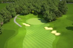
Other applications include creating 3D maps for marketing, analyzing the terrain for outdoor activities, creating virtual tours of properties, and many more.
Drone Aerial 3D Mapping Hardware
The hardware required for drone aerial 3D mapping is relatively simple. The most important piece of hardware is the drone itself.
The type of drone you need depends on the type of 3D map you want to create. If you want to create a detailed 3D map, you will need a drone with a high-resolution camera. You will also need a controller for the drone and a monitor to view the live feed from the drone’s camera.
Drone Aerial 3D Mapping Software
The software required for drone aerial 3D mapping depends on the type of 3D map you want to create.
If you want to create a detailed 3D map, you will need a software program that can stitch together the multiple photographs taken by the drone. Popular programs include Pix4D and DroneDeploy.
If you want to create an interactive 3D map, you will need a software program that can create an interactive 3D model of the area. Popular programs include Mapbox and Cesium.
Creating Your Drone Aerial 3D Mapping Plan
Before you begin drone aerial 3D mapping, it is important to create a plan. This plan should include the type of 3D map you want to create, the resolution of the photographs you want to take, the area you want to map, and any other important details.
It is also important to plan for safety. You should always follow safety guidelines and make sure to check local laws and regulations before flying your drone.

Drone Aerial 3D Mapping Tips
When creating a 3D map with a drone, there are a few tips you should keep in mind.
First, make sure to fly the drone at a constant speed and altitude. This will help ensure that the photographs taken by the drone are consistent and will create a more accurate 3D map.
Second, make sure to take multiple photographs of the same area. This will help ensure that you have enough data to create a detailed 3D map.
Finally, make sure to use a high-resolution camera. The higher the resolution of the camera, the more detailed the 3D map will be.
Courses for Drone Aerial 3D Mapping
If you are new to drone aerial 3D mapping, there are a number of courses available to help you get started.
The Drone U online course is a comprehensive guide to drone aerial 3D mapping. It includes lessons on how to set up and fly a drone, how to create a 3D map, and how to use the data to analyze the terrain.
There are also a number of other online courses available for drone aerial 3D mapping. These courses are often more specific and focus on a particular application or type of drone.
Drone Aerial 3D Mapping Services
If you don’t have the time or expertise to create your own 3D map, there are a number of companies that offer drone aerial 3D mapping services.
These companies can provide you with the hardware and software needed to create a 3D map and can even fly the drone for you. This can be a great option if you don’t have the time or expertise to create your own 3D map.
Conclusion
Drone aerial 3D mapping is revolutionizing the way businesses and organizations view the world around them. By utilizing drones, modern technology, and sophisticated software, aerial 3D mapping can quickly create detailed, accurate three-dimensional representations of large areas in a fraction of the time it would take using traditional methods. This gives users the opportunity to gain insight into their environment in ways they never thought possible. From surveying land for construction projects to creating interactive 3D maps for marketing, drone aerial 3D mapping is transforming the way we view and interact with the world.
314-604-6544
stlouisaerialphotography@gmail.com
Robert Haller, Drone Specialist
