Drone Inspections: How to Spot Solar Panel Problems Fast

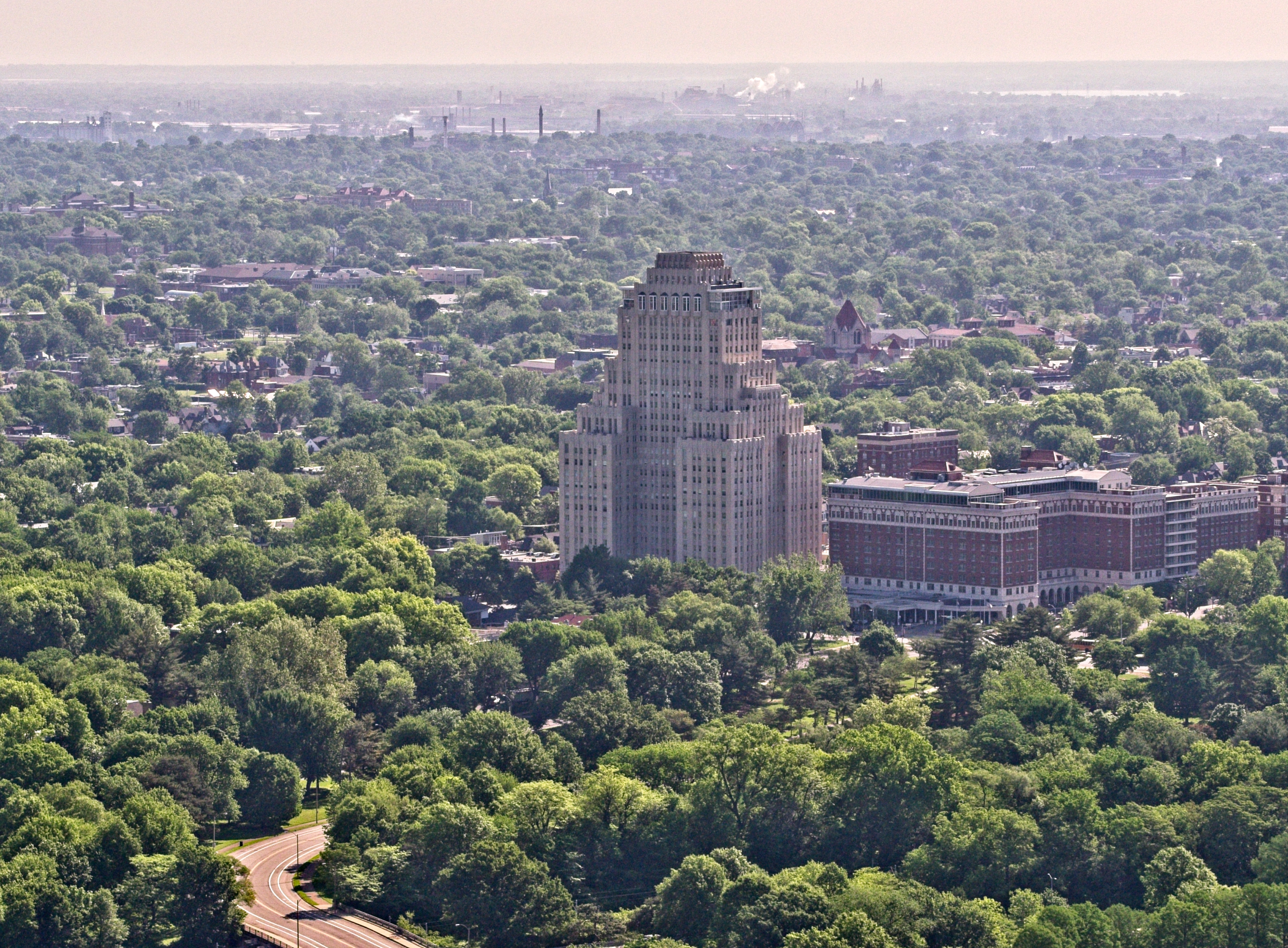
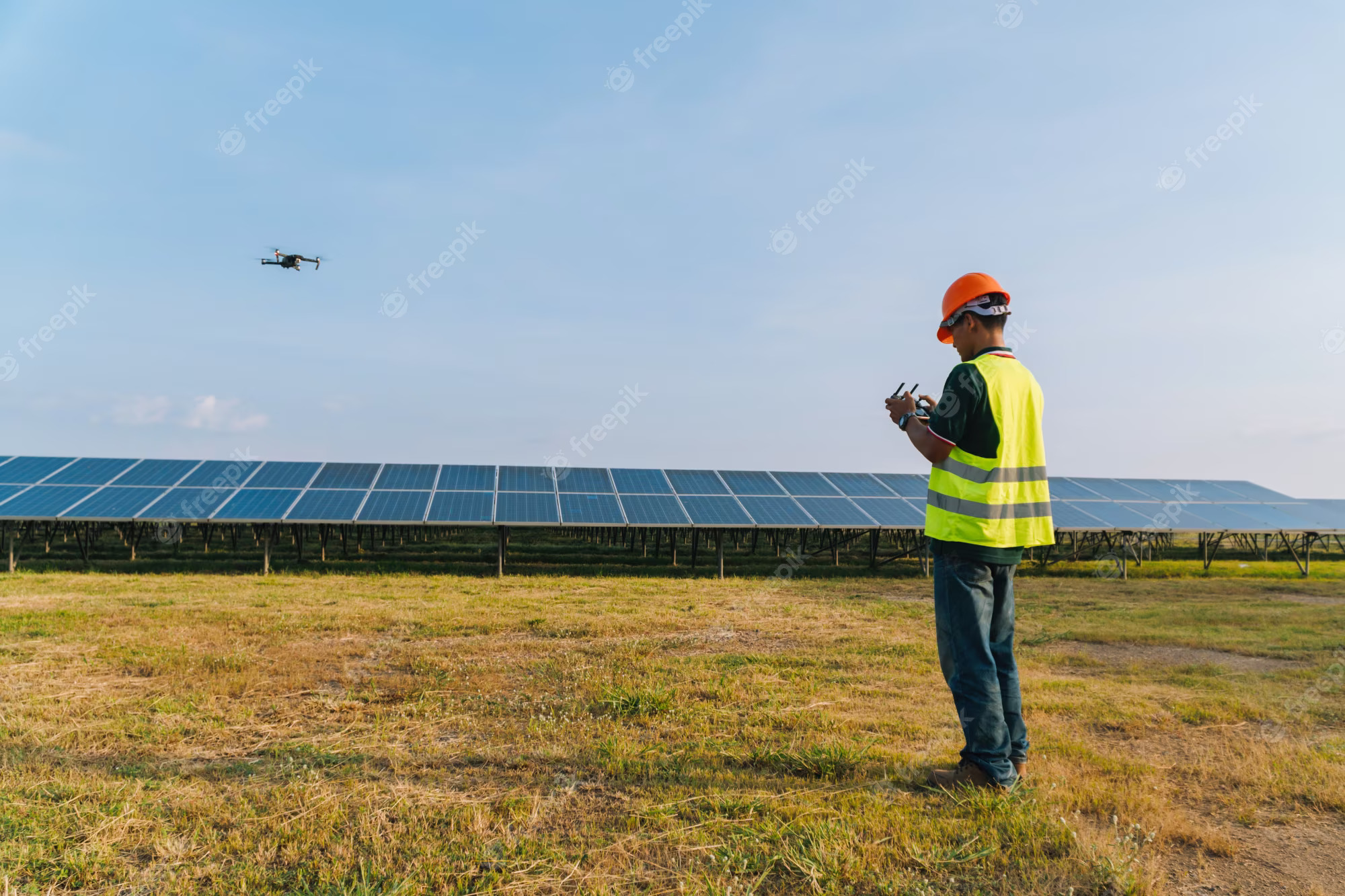
As the demand for sustainable energy solutions continues to rise, businesses and organizations are increasingly investing in solar power. However, to maximize the efficiency and longevity of solar panels, regular inspections and maintenance are crucial. Traditional inspection methods can be time-consuming and costly, but drone technology is revolutionizing the process. St. Louis Aerial Photography specializes in professional drone inspections, helping businesses identify and address solar panel issues quickly and efficiently.

Drones collect high-resolution images and thermal scans to detect abnormalities such as hot spots, dirt accumulation, and wiring faults.

The Importance of Solar Panel Inspections

Solar panels are exposed to various environmental conditions that can affect their performance over time. Common issues include:

  • Cracked or damaged panels – Hail, falling debris, or manufacturing defects can cause structural damage.
  • Dirt and debris accumulation – Dust, bird droppings, and other particles can reduce energy absorption.
  • Defective wiring and connections – Electrical faults can disrupt energy production and pose safety hazards.
  • Hot spots – Overheating due to shading, defective cells, or electrical imbalances can lead to permanent damage.
  • Inefficient panel alignment – Improper angling or misalignment can reduce energy efficiency.

How Drone Inspections Work

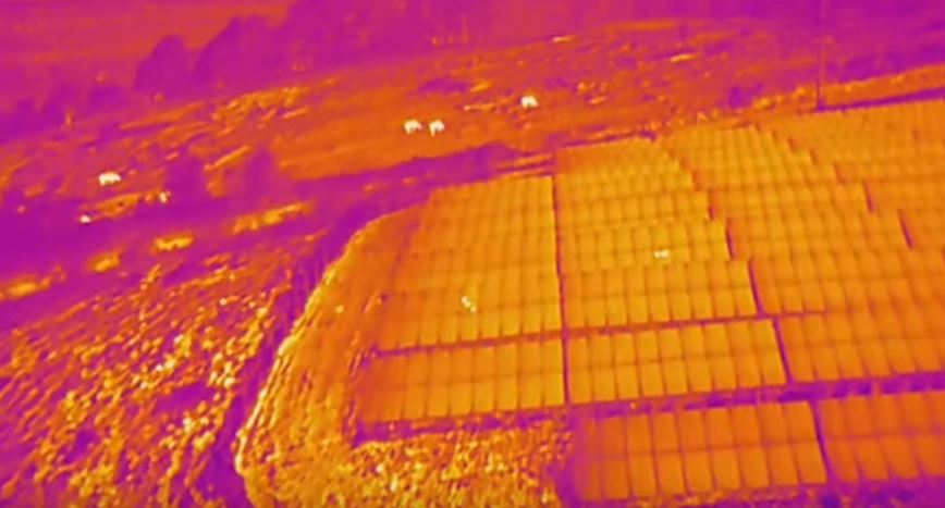
Drones equipped with high-resolution cameras and thermal imaging sensors provide a comprehensive view of solar panel arrays. This technology enables quick identification of potential problems without the need for manual, labor-intensive inspections.

  1. Aerial Imaging & Thermal Scanning
    • Drones capture high-resolution images and videos of the entire solar panel installation.
    • Thermal cameras detect temperature variations that indicate malfunctions such as hot spots, wiring issues, or shading problems.
  2. Data Analysis & Issue Identification
    • Advanced software processes the collected data, identifying inconsistencies and pinpointing areas that require maintenance.
    • Engineers and maintenance teams can then take precise corrective actions, reducing downtime and operational costs.
  3. Cost-Effective & Time-Efficient
    • Drone inspections take a fraction of the time compared to traditional manual methods.
    • Reduced labor costs and improved efficiency lead to higher returns on investment for businesses relying on solar energy.

Benefits of Drone Inspections for Businesses

  • Enhanced Safety – Avoids the risks of sending personnel to climb on rooftops or large-scale solar farms.
  • Minimized Downtime – Quick identification of faults leads to faster repairs and optimized energy output.
  • Scalability – Drones can efficiently inspect solar panel installations of any size, from small businesses to large commercial solar farms.
  • Comprehensive Reporting – Detailed visual and thermal analysis provides clear insights for decision-makers.

Why Choose St. Louis Aerial Photography?

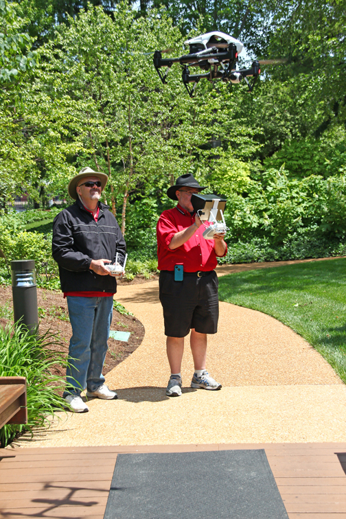
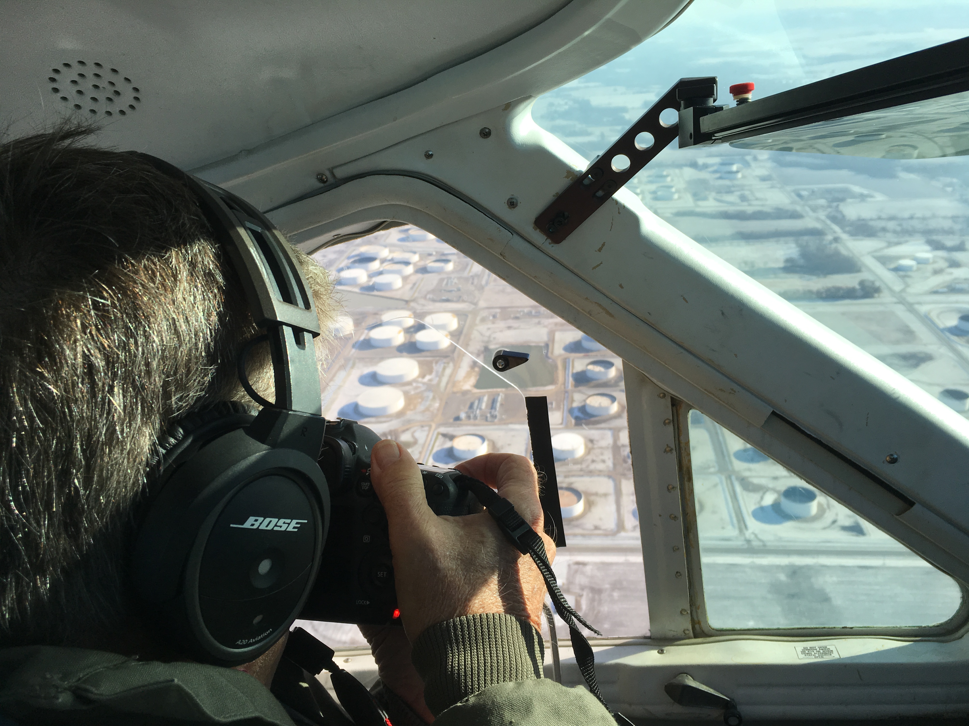
At St. Louis Aerial Photography, we understand the critical role that solar energy plays in today’s business environment. As a full-service professional commercial photography and video production company, we have the right equipment and creative crew service experience for successful image acquisition. Our licensed drone pilots utilize state-of-the-art technology to conduct detailed aerial inspections tailored to your specific needs.

Beyond drone inspections, we offer full-service studio and location video and photography, as well as editing, post-production, and branding solutions. We specialize in repurposing photography and video branding to help businesses gain more traction in their marketing efforts. With extensive experience in all media file types, styles, and accompanying software, we can optimize content for multiple platforms.

Our private studio lighting and visual setup are ideal for small productions and interview scenes. For larger productions, our spacious studio can incorporate props to enhance your set design. Whether you need a private custom interview studio setup, sound and camera operators, or specialized drone operations—including indoor flights—our team has everything required to make your next production seamless.

Since 1982, St. Louis Aerial Photography has collaborated with businesses, marketing firms, and creative agencies across the St. Louis area. Our expertise in commercial drone services ensures precise and efficient solar panel inspections, allowing you to maintain optimal energy performance. Contact us today to learn how our professional drone services can benefit your solar energy system.

314-604-6544

stlouisaerialphotography@gmail.com

The Benefits of Drone Technology for Stockpile Reporting

In industries like mining, construction, and aggregates, the need for accurate stockpile measurement and management is paramount. Traditional methods of assessing stockpile volumes can be labor-intensive, time-consuming, and sometimes inaccurate. However, the rise of drone technology has transformed this process, offering a more efficient, precise, and safer solution. This guide explores how drones are revolutionizing stockpile management and why they should be an integral part of your operations.

Drones equipped with advanced cameras and sensors capture detailed, geo-referenced images from above the worksite. These images are processed using sophisticated photogrammetry software to create highly accurate 3D maps.

Why Use Drones for Stockpile Reporting?

Efficiency and Time Savings

Speeding up data collection: Traditional methods for measuring stockpiles can be cumbersome, often taking several hours or even days to complete, depending on the size and complexity of the site. Drones can accomplish the same task in mere minutes. This significant reduction in time not only saves costs but also allows for more frequent surveys, ensuring that your inventory data is always up-to-date.

Precision and Accuracy

Delivering high-resolution, geo-referenced data: Drones are equipped with advanced cameras and sensors that capture high-resolution images of your site from above. These images are processed using specialized photogrammetry software to create detailed 3D maps. The precision of these measurements, often accurate to within a few centimeters, provides reliable data essential for inventory management and planning.

Enhanced Safety

Minimizing risks with remote data collection: Traditional stockpile measurement methods can be hazardous, often requiring workers to climb unstable piles or operate in close proximity to heavy machinery. Drones eliminate the need for physical contact with the stockpiles, significantly reducing the risk of accidents and improving overall site safety.

How Drone Surveys Work

Data Collection

Capturing detailed aerial images: A drone equipped with a high-resolution camera flies over the site, capturing a series of overlapping images. These images are geo-referenced, meaning they are tagged with precise GPS coordinates, ensuring accurate spatial data for further processing.

Data Processing

Creating accurate 3D models: The captured images are processed using photogrammetry software, which stitches them together to generate an intricate 3D map of the site. This map can be used to take various measurements, including stockpile volumes, surface areas, and elevation changes.

Data Analysis and Reporting

Providing actionable insights: Drone survey software leverages the accuracy of the 3D maps to generate comprehensive reports. You can compare current stockpile volumes to previous surveys, track site progress, and even measure against final grade design files to determine how much material needs to be added or removed. This detailed data supports better decision-making and project management.

Applications of Drone Technology in Stockpile Management

Mining and Aggregates

Optimizing resource management: For professionals in the mining and aggregates industries, drone surveys offer a reliable and efficient way to manage stockpile inventories. Accurate volume calculations help maintain optimal stock levels, plan extraction activities, and ensure efficient use of resources.

Construction Sites

Improving project oversight: Construction sites benefit greatly from drone surveys, which allow for quick and accurate assessments of large areas. The detailed 3D maps provide valuable insights into site progress, material needs, and adherence to design specifications, helping keep projects on track and within budget.

Environmental Monitoring

Supporting sustainability and compliance: Drones also play a critical role in environmental monitoring by tracking changes in landscapes and ensuring compliance with environmental regulations. High-resolution images and 3D models help assess the impact of mining and construction activities, promoting sustainable practices and regulatory adherence.

Why Choose St Louis Aerial Photography for Your Drone Survey Needs?

At St Louis Aerial Photography, we are a full-service professional commercial photography and video production company specializing in high-quality image and stockpile inventory data acquisition. Our team combines cutting-edge technology with creative expertise to deliver outstanding results tailored to your business needs.

Comprehensive Services

Customized solutions for every requirement: We offer a wide range of services, including studio and location video and photography, editing, post-production, and licensed drone pilots. Our ability to customize productions means we can meet diverse media needs, from repurposing your branding materials to helping you achieve greater market visibility.

Advanced Equipment and Expertise

State-of-the-art tools and facilities: Our private studio is equipped with professional lighting and visual setups, perfect for small productions and interviews. The studio space can be customized with props to create a complete set for your production. Additionally, we offer specialized drones capable of indoor flights, providing versatile solutions for any production scenario.

Experienced Team

Supporting you from start to finish: Our experienced team is here to assist with every aspect of your production, from setting up custom interview studios to providing skilled sound and camera operators. We have the equipment and know-how to make your next video production flawless.

Proven Success

Trusted by industry leaders: St Louis Aerial Photography has successfully partnered with numerous businesses to gather critical data and measure stockpiles accurately. Our commitment to accuracy, efficiency, and safety has made us a trusted provider in the industry.

In conclusion, drone technology offers significant benefits for stockpile reporting, including increased efficiency, enhanced accuracy, and improved safety. At St Louis Aerial Photography, we are committed to delivering the best results for your business through expert drone surveys and comprehensive video production services. Contact us today to learn how we can assist with your next project.


St Louis Aerial Photography – Your Partner in Professional Aerial Imaging and Video Production

314-604-6544

stlouisaerialphotography@gmail.com

Product Photography Studio Techniques for Capturing the Perfect Shot

In today’s visually driven market, high-quality product photography is crucial for businesses aiming to make a strong impression. The right imagery can set your brand apart, captivating potential customers and driving engagement. For decision-makers responsible for selecting photography and video production services, understanding advanced studio techniques can significantly impact the effectiveness of your visual content. This article delves into expert techniques for capturing the perfect shot in a studio setting.

Mastering the Fundamentals

Before exploring advanced methods, it’s essential to solidify the foundational aspects of product photography:

  1. Lighting: The quality of light can make or break a photo. Soft, diffused lighting helps to eliminate harsh shadows and highlights, creating a balanced and appealing image. Employing a combination of key lights, fill lights, and backlights can enhance the depth and dimension of the product.
  2. Backgrounds: A clean, distraction-free background ensures that the product remains the focal point. White backgrounds are popular for their simplicity, but colored or textured backgrounds can add a creative flair and highlight different product features.
  3. Composition: The arrangement of elements within the frame is critical. Use the rule of thirds, leading lines, and framing techniques to guide the viewer’s eye towards the product, creating a harmonious and engaging composition.

Advanced Studio Techniques

1. Focus Stacking

Focus stacking involves taking multiple images of the same subject at varying focus distances and merging them in post-production. This technique ensures every part of the product is in sharp focus, resulting in a detailed and crisp final image. It’s particularly beneficial for products with intricate details that need to be highlighted.

2. Lighting Modifiers

The use of lighting modifiers such as softboxes, reflectors, and diffusers can drastically improve the quality of light. Softboxes create soft, even illumination, minimizing harsh shadows. Reflectors bounce light back onto the product, filling in shadows and adding depth. Diffusers soften the light, making it more flattering for reflective or glossy surfaces.

3. Creative Angles and Perspectives

Exploring various angles and perspectives can add a unique touch to your product photography. Shooting from above, below, or at unconventional angles can showcase the product’s features in an engaging manner. Macro photography, which captures extreme close-ups, is excellent for highlighting fine details and craftsmanship.

4. Post-Production Mastery

Editing plays a vital role in product photography. Software like Adobe Photoshop and Lightroom allows for color enhancement, exposure adjustment, and imperfection removal. Techniques such as color grading, retouching, and background removal can elevate an image from good to great. Consistent editing styles help maintain a cohesive brand identity.

5. Utilizing Props and Context

Incorporating props can provide context and scale, aiding customers in visualizing the product’s use. However, it’s crucial to ensure that props complement rather than overshadow the product. They should enhance the story you’re telling and add to the product’s appeal.

Why Choose St Louis Aerial Photography?

At St Louis Aerial Photography, we combine technical prowess with creative expertise to deliver exceptional product photography. As a full-service professional commercial photography and video production company, we offer a comprehensive suite of services:

  • Studio and Location Video and Photography: Whether you need controlled studio shoots or dynamic on-location photography, our team is equipped to handle it all.
  • Editing and Post-Production: Our skilled editors are adept in all types of media and software, ensuring your photos are polished and professional.
  • Licensed Drone Pilots: For unique and captivating aerial perspectives, our licensed drone pilots can capture stunning visuals.
  • Custom Productions: We tailor our services to meet your specific media requirements, ensuring your brand stands out in a crowded market.
  • Repurposing for Branding: We specialize in adapting your photography and video content for various platforms, maximizing your reach and impact.
  • Private Studio Setup: Our studio is ideal for small productions and interview scenes, with ample space for props to enhance your setup.
  • Comprehensive Support: From private custom interview setups to providing sound and camera operators, we have everything you need for a flawless production.

With extensive experience collaborating with businesses, marketing firms, and agencies in the St. Louis area, St Louis Aerial Photography is your trusted partner for all your corporate photography and video needs. Our commitment to excellence ensures that your products are showcased in the best possible light, driving engagement and boosting your brand’s image.


By employing these advanced studio techniques and partnering with a professional service like St Louis Aerial Photography, you can significantly elevate your product photography. Contact us today to discuss how we can help you capture the perfect shot for your brand.

314-604-6544

stlouisaerialphotography@gmail.com

Drones Redefining Stockpile Reporting

In recent years, the use of drones in various industries has soared to new heights. From agriculture to construction, these aerial marvels have found their way into numerous sectors, offering innovative solutions and transforming the way businesses operate. One of the areas where drones are making a significant impact is in stockpile reporting. In this comprehensive article, we will delve into the world of stockpile reporting and explore how experienced professionals at St. Louis Aerial Photography are leading the way in utilizing drones for this essential task.

Drones can cover large areas quickly, reducing the time and effort required for data collection.

What is Stockpile Reporting?

Before we dive into the role of drones in stockpile reporting, let’s first understand what stockpile reporting entails. Stockpile reporting is a critical aspect of inventory management for various industries, including construction, mining, and agriculture. It involves the measurement and documentation of stockpiled materials such as gravel, sand, coal, or agricultural products. Accurate stockpile reporting is essential for inventory control, financial planning, and compliance with regulations.

Traditionally, stockpile reporting was a labor-intensive process that involved manual measurements, surveying equipment, and a significant amount of time and resources. However, the introduction of drone technology has revolutionized this practice, making it more efficient, accurate, and cost-effective.

The Role of Drones in Stockpile Reporting

Drones, also known as Unmanned Aerial Vehicles (UAVs), have become indispensable tools for stockpile reporting for several reasons:

1. Aerial Perspective

Drones provide a unique vantage point by capturing high-resolution aerial images and videos. This perspective allows for a comprehensive view of the entire stockpile, eliminating the need for time-consuming ground measurements.

2. Speed and Efficiency

Traditional stockpile reporting methods can be time-consuming and require significant manpower. Drones can cover large areas quickly, reducing the time and effort required for data collection. This efficiency translates into cost savings for businesses.

3. Precision and Accuracy

Modern drone technology is equipped with advanced sensors and GPS systems that ensure precise measurements. The data collected by drones is highly accurate, reducing the margin of error associated with manual measurements.

4. Safety

Stockpile reporting often involves hazardous environments, such as construction sites or mining operations. Using drones eliminates the need for workers to enter these dangerous areas, enhancing safety protocols.

How St. Louis Aerial Photography Excels in Stockpile Reporting

At St. Louis Aerial Photography, we take pride in being at the forefront of utilizing drones for stockpile reporting. Our experienced team of drone pilots and scriptwriters understands the unique requirements of stockpile reporting and has the expertise to deliver exceptional results. Here’s why our company stands out:

1. State-of-the-Art Equipment

We invest in the latest drone technology and equipment, ensuring that we have the best tools for the job. Our drones are equipped with high-resolution cameras and advanced sensors to capture precise data.

2. Creative Crew Service Experience

Our team includes creative professionals who can craft compelling narratives and scripts for stockpile reporting videos. We understand that effective communication is key to conveying the significance of the data we collect.

3. Full-Service Studio and Location Video Recording

We offer both studio and on-location video recording services, providing flexibility to our clients. Whether you need to capture stockpile data in a controlled studio environment or in the field, we have you covered.

4. Photography Expertise

In addition to video recording, we excel in photography. Our photographers can capture stunning images of your stockpiles, showcasing their size and scale.

5. Customization and Repurposing

We understand that different industries have unique needs when it comes to stockpile reporting. Our team can customize video productions to meet your specific requirements. Furthermore, we can repurpose the data and media we collect to gain more traction across various platforms.

6. Proficiency in Drone Media Software and Editing

Our team is well-versed in all file types and styles of drone media software and editing. We can transform raw data into informative and visually appealing reports.

Experience the Difference with St. Louis Aerial Photography

As a full-service drone video creation company, St. Louis Aerial Photography has worked with many companies in the St. Louis area to create ground and aerial videos for their communication needs. We have experienced drone videographers, producers, and editors to create insightful volumetric reporting.

In conclusion, drones are redefining stockpile reporting by offering speed, accuracy, and safety advantages over traditional methods. At St. Louis Aerial Photography, we have the right equipment, creative crew service experience, and expertise to provide top-notch stockpile reporting solutions tailored to your industry’s needs. Contact us today to learn more about how we can transform your stockpile reporting processes and elevate your business.

Experience the future of stockpile reporting with St. Louis Aerial Photography.

314-604-6544

stlouisaerialphotography@gmail.com

Enhancing Safety and Accuracy: Drones for Infrared Inspections

In recent years, the use of drones has revolutionized various industries, and one area where their impact is particularly significant is in infrared inspections. As an experienced drone pilot and infrared technician at St. Louis Aerial Photography & Video, I am excited to share insights into how drones are transforming the field of infrared inspections, enhancing safety, and improving accuracy.

By deploying drones equipped with infrared cameras, inspectors can access hard-to-reach or hazardous areas without endangering themselves.

The Power of Infrared Inspections

Before we delve into the role of drones in infrared inspections, let’s understand the importance of this technology. Infrared thermography, commonly known as thermographic inspections, utilizes infrared cameras to detect and visualize thermal patterns on the surface of objects and structures. These thermal patterns can reveal hidden issues such as electrical faults, energy inefficiencies, moisture intrusion, and structural defects.

Traditionally, infrared inspections required technicians to physically access the areas of interest, which often posed significant safety risks, especially in industrial settings. Additionally, manual inspections were time-consuming and less comprehensive. Enter drones, which have transformed the way we conduct infrared inspections.

Drones in Infrared Inspections

1. Enhanced Safety

Safety is paramount in any inspection process, and drones have significantly improved safety standards in the field of infrared inspections. By deploying drones equipped with infrared cameras, inspectors can access hard-to-reach or hazardous areas without endangering themselves.

For instance, inspecting high-voltage power lines or the roofs of large industrial facilities used to involve climbing and putting technicians at risk. With drones, we can now fly over these areas, capturing thermal data from a safe distance. This not only protects the inspectors but also reduces the downtime associated with safety procedures.

2. Increased Efficiency

Drones have also revolutionized the efficiency of infrared inspections. Manual inspections are often labor-intensive and time-consuming, requiring inspectors to meticulously scan every square inch of a structure. Drones equipped with thermal cameras can cover large areas quickly, providing a comprehensive overview of the thermal landscape in a fraction of the time.

3. Cost-Effective

Infrared inspections with drones are not only efficient but also cost-effective. Traditional methods may require significant manpower and resources. With drones, you can achieve the same or even better results with fewer personnel, reducing operational costs. This cost efficiency makes infrared inspections accessible to a wider range of industries and businesses.

4. Accurate Data Collection

Accuracy is crucial in infrared inspections, as the data collected is used for critical decision-making. Drones equipped with high-resolution thermal cameras capture precise thermal imagery, ensuring that the data is reliable and actionable. This accuracy is especially valuable in industries such as building maintenance, energy auditing, and predictive maintenance.

5. Versatility

Drones are incredibly versatile and can adapt to various inspection scenarios. Whether it’s inspecting solar panels on a commercial building, assessing the integrity of wind turbine blades, or identifying water leaks in a large industrial facility, drones can be customized to meet specific inspection needs.

St. Louis Aerial Photography & Video: Your Infrared Inspection Partner

At St. Louis Aerial Photography & Video, we have positioned ourselves as a leading full-service infrared drone production and post-production company. Our team of experienced drone pilots and technicians is equipped with state-of-the-art thermal imaging equipment to provide accurate and insightful reporting.

Full-Service Studio and Location Video Recording and Editing

Our capabilities extend beyond infrared inspections. We offer full-service studio and location video recording and editing services. Whether you need an informative video showcasing your facility’s infrared inspection process or a comprehensive report presentation, our creative crew has the expertise to deliver compelling content.

Customized Video Productions

We understand that different industries have unique reporting needs. That’s why we specialize in customizing video productions to meet diverse requirements. Our experience spans across various sectors, including manufacturing, construction, energy, and more. We tailor our services to ensure that your specific needs are met.

Repurposing for Maximum Traction

Repurposing your video productions can maximize their impact. Our team is skilled in repackaging and repurposing content to reach a wider audience. Whether it’s creating shorter clips for social media or extracting key insights for internal use, we help you leverage your investment in infrared inspections to gain more traction.

Expertise in Infrared Media Software and Reporting

In the realm of infrared inspections, we are well-versed in all file types and styles of infrared media software and reporting. We ensure that the data we collect is not only accurate but also presented in a format that is easily understandable and actionable.

Call to Action

As a full-service video creation company, St. Louis Aerial Photography & Video has worked with many commercial businesses in the St. Louis area to create their building infrared reports. We have experienced drone videographers and producers to create insightful, accurate reporting. Our commitment to safety, efficiency, and accuracy makes us your ideal partner for all your infrared inspection needs.

In conclusion, the marriage of drones and infrared technology has opened up new possibilities in the field of inspections. The enhanced safety, efficiency, and cost-effectiveness offered by drones make them an invaluable tool for businesses and industries looking to ensure the integrity of their assets and facilities. At St. Louis Aerial Photography & Video, we are not just embracing this technology; we are leading the way in delivering top-notch infrared inspection services. Contact us today to discuss how we can elevate your infrared inspection processes and deliver actionable insights that drive informed decision-making.

Contact us now to schedule your next infrared inspection and experience the difference that expertise, cutting-edge equipment, and creative solutions can make.

314-604-6544

stlouisaerialphotography@gmail.com

Drones used in construction will keep you informed and on schedule for your project.

Drones are changing how construction job sites are managed by providing progress photos, stockpile quantities, and other data. Instead of using outdated Google maps, a drone can provide an up-to-date view of a property.

BJC Queeny Tower construction progression with drone video and photography

For example, we can capture aerial images at different altitudes to provide you with a bird’s eye view of what your current tenants would see out of every window.

Zoning meetings can be conducted without waiting for the zoning commission to send a representative. Use drones and maps to save time, money, and accelerate the approval process. It’s all about saving time, cash, and speeding up the approval process.

Document the job site’s condition (and the roads leading to it) before you start working. We can record the condition of the roads before your trucks and heavy equipment arrive.

Capture the interior progress of your project. We offer comprehensive interior drone footage services. This is a great way to offer progress insights, provide a view of your interior and keep stakeholders informed as your job progresses.

314-604-6544
stlouisaerialphotography@gmail.com
Robert Haller, Drone Specialist

St Louis Aerial Photography, Video and Stock Footage


Film Production
Feature, indie, shorts, commercials, music videos. We shoot for a myriad of different productions, producers and advertising agencies, as well as directly with the client.

Live Events
We don’t only capture live events, concerts, and sports, we create actual onsite productions that tell your story and engage your audience

Real Estate
Showcase your real estate and give your potential customers a first hand view at their property and neighborhood.

At the end of the day, the most important factor in realizing your creative vision is the skill of the team behind the technology, which is why our crew includes some of the most experienced pilots and camera specialists in the industry.

St Louis Aerial Photography, Video and Stock Footage

314-604-6544
stlouisaerialphotography@gmail.com
Robert Haller, Drone Specialist

Drones, Airplanes and Helicopters | Aerial Photography

St Louis Aerial Photography specializes in low altitude, high resolution aerial photography services.  We utilize customized unmanned drone aircraft as our camera platforms.  This, in conjunction with GPS electronics, the latest cameras, and a gyro stabilized brushless gimbal, provide an aerial platform for capturing stunningly clear high resolution video, photo, panorama, and orbital.

Our unmanned drone aircraft can be deployed quickly with minimal equipment.  Our aerial images are captured from altitudes anywhere from 100 to 400 feet.  This lets us obtain images from angles and perspectives which full-sized aircraft cannot.  Because of its small size, the unmanned drone aircraft can safely take-off and land in tight areas.  It is also quiet and unobtrusive.  Browse our website to better understand how we can help you elevate your next project for an impressive presentation for your website and marketing video tools.

We can also provide traditional airplanes and helicopters for your shoot.
We have two professional pilots and photographers. We own our own Cessna 177 Cardinal and we use the latest in high-resolution digital cameras, and technology, so we have the right equipment to capture exactly the view you need. Our senior pilot has been flying for over 40 years with more that 15 of those in the Aerial Photography Business.  He keeps up to date on the latest in Aerial photography practices and digital technology by his regular contributions and attendance at seminars and conventions.

Our other pilot has been flying for 14 years, has trained at photography schools, and attended professional seminars on digital photograph enhancement techniques. His specialist expertise in photography and digital artwork combine to give you the best product available in the market.

314-604-6544
stlouisaerialphotography@gmail.com
Robert Haller, Drone Specialist